Home > Europe > United Kingdom > England > Bristol > Ridgeway
Gravesham DA12 5 Map

![]()
Wall Art and Photo Gifts from Map Marketing
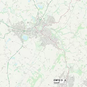
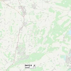
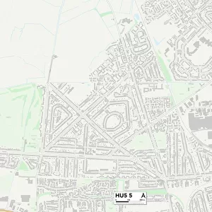
Gravesham DA12 5 Map
Postcode Sector Map of Gravesham DA12 5
Media ID 19968680
Aintree Close Arnold Road Ascot Road Ash Road Avon Close Bristol Road Burton Road Canterbury Road Cedar Avenue Central Avenue Cheltenham Close Coombe Road Dorchester Road Elm Road Epsom Close Evesham Road Exeter Road Ferguson Avenue Ferndale Road Franklin Road Gloucester Road Gravesham Hawthorn Close Hillside Avenue Hollybush Road Hudson Close Ivy Close Kings Drive Laurel Avenue Lingfield Road Livingstone Road Mallory Close Maple Road Montgomery Close Nansen Road North Lane Nursery Grove Oak Road Palmer Avenue Poplar Avenue Portland Avenue Princes Road Queens Road Raleigh Close Ridgeway Avenue Sandown Road School Road Scott Road St Albans Close Stanley Crescent Sun Lane The Glades The Hollies Thomas Drive Treetops Truro Road Watling Street West Court Westfield Close Westwood Whitehill Lane Whitehill Road Windsor Road Wye Road York Road Broadwood
FEATURES IN THESE COLLECTIONS
> Animals
> Birds
> Passerines
> Finches
> Brambling
> Arts
> Artists
> H
> Thomas Hudson
> Arts
> Artists
> N
> Thomas North
> Europe
> France
> Canton
> Landes
> Europe
> United Kingdom
> England
> Avon
> Europe
> United Kingdom
> England
> Bristol
> Bristol
> Europe
> United Kingdom
> England
> Bristol
> Ridgeway
> Europe
> United Kingdom
> Wales
> Powys
> Montgomery
> Map Marketing
> Postcode Sector Maps
> DA - Dartford
> Maps and Charts
> Related Images
MADE IN THE USA
Safe Shipping with 30 Day Money Back Guarantee
FREE PERSONALISATION*
We are proud to offer a range of customisation features including Personalised Captions, Color Filters and Picture Zoom Tools
SECURE PAYMENTS
We happily accept a wide range of payment options so you can pay for the things you need in the way that is most convenient for you
* Options may vary by product and licensing agreement. Zoomed Pictures can be adjusted in the Cart.