Pte Josiah Egerton Hills undated map of South Africa

![]()
Wall Art and Photo Gifts from Mary Evans Picture Library
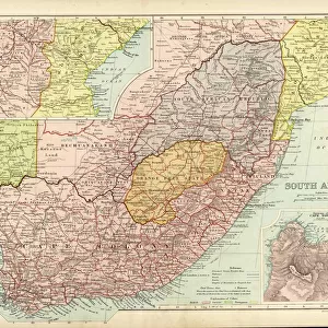
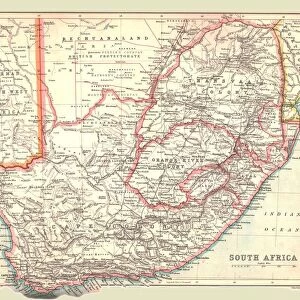
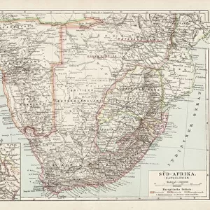
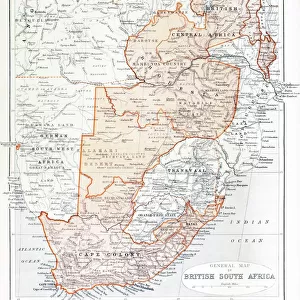
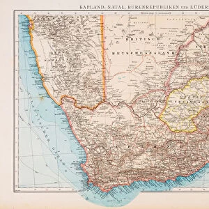
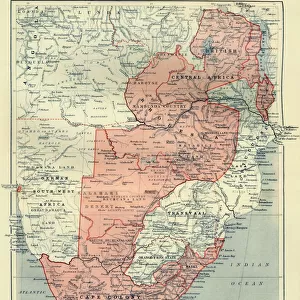
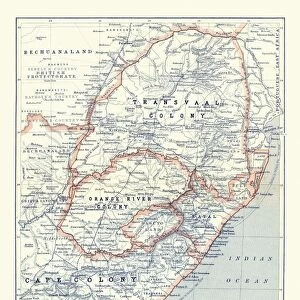
Pte Josiah Egerton Hills undated map of South Africa
Copy of Pte Josiah Egerton Hills undated map of South Africa, showing the route taken by the South Nottinghamshire Yeomanry. Date: 1900
Mary Evans Picture Library makes available wonderful images created for people to enjoy over the centuries
Media ID 14389877
© The National Army Museum / Mary Evans Picture Library
Boer Copy Egerton Josiah Nottinghamshire Ranks Route Undated Yeomanry
EDITORS COMMENTS
This intriguing map, a copy of an undated work by Pte. Josiah Egerton Hills, offers a unique glimpse into the South African campaign during the Boer War of 1900. The map meticulously charts the route taken by the South Nottinghamshire Yeomanry, a British Imperial Yeomanry regiment, as they traversed the rugged terrain of South Africa. The South Nottinghamshire Yeomanry, a part-time military force, played a significant role in the Second Boer War, which lasted from 1899 to 1902. The conflict arose from tensions between the British colonial authorities and the two independent Boer states, the Transvaal and the Orange Free State. The Boer farmers, or Afrikaners, resented British encroachment on their lands and sought independence. Pte. Josiah Egerton Hills, a member of the South Nottinghamshire Yeomanry, created this map to document the regiment's journey through South Africa. The map includes various towns, rivers, and geographical features, providing a valuable historical record of the region. The route begins in the northern Cape Colony and heads southwards, passing through towns such as Bloemfontein, Winburg, and Brandfort. The map also includes various military camps and engagements, such as the Battle of Magersfontein and the Battle of Belmont, where the South Nottinghamshire Yeomanry participated. The regiment's involvement in these battles underscores the importance of this map as a primary source for understanding the military strategy and tactics employed during the Boer War. The map's intricate detail and accuracy reflect the meticulous planning and execution required for a successful military campaign. The South Nottinghamshire Yeomanry's journey, as depicted on this map, is a testament to the bravery and determination of the British forces during the Boer War. This rare and fascinating map provides a valuable insight into a pivotal moment in South African and imperial history.
MADE IN THE USA
Safe Shipping with 30 Day Money Back Guarantee
FREE PERSONALISATION*
We are proud to offer a range of customisation features including Personalised Captions, Color Filters and Picture Zoom Tools
SECURE PAYMENTS
We happily accept a wide range of payment options so you can pay for the things you need in the way that is most convenient for you
* Options may vary by product and licensing agreement. Zoomed Pictures can be adjusted in the Cart.