Home > Europe > United Kingdom > England > London > Boroughs > Havering
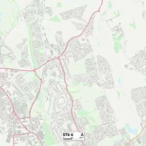
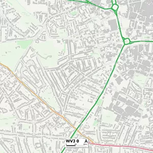
Havering RM7 9 Map

![]()
Wall Art and Photo Gifts from Map Marketing
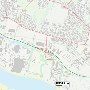
Havering RM7 9 Map
Postcode Sector Map of Havering RM7 9
Media ID 19979151
Albion Close Burlington Avenue Cromer Road Derby Avenue Eastbury Road Havering Honiton Road Jubilee Avenue Jubilee Close Kensington Road Kimberley Avenue Knighton Close Knighton Road London Road Lonsdale Avenue Norfolk Road Queen Street Southern Way Spring Gardens St Andrews Road Stanford Close Waterloo Road Yew Tree Gardens
FEATURES IN THESE COLLECTIONS
> Europe
> United Kingdom
> England
> London
> Boroughs
> Havering
> Europe
> United Kingdom
> England
> London
> Boroughs
> Kensington and Chelsea
> Europe
> United Kingdom
> England
> London
> Sights
> Kensington Gardens
> Europe
> United Kingdom
> England
> London
> Towns
> Kensington
> Europe
> United Kingdom
> England
> London
> Towns
> Waterloo
> Europe
> United Kingdom
> England
> London
> Towns
> West Kensington
> Europe
> United Kingdom
> England
> Norfolk
> Cromer
> Europe
> United Kingdom
> England
> Norfolk
> Kimberley
> Europe
> United Kingdom
> England
> Norfolk
> Related Images
> Europe
> United Kingdom
> England
> Norfolk
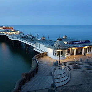
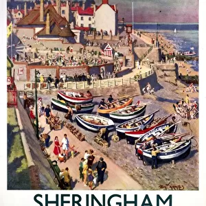
> Sheringham
> Map Marketing
> Postcode Sector Maps
> RM - Romford
MADE IN THE USA
Safe Shipping with 30 Day Money Back Guarantee
FREE PERSONALISATION*
We are proud to offer a range of customisation features including Personalised Captions, Color Filters and Picture Zoom Tools
SECURE PAYMENTS
We happily accept a wide range of payment options so you can pay for the things you need in the way that is most convenient for you
* Options may vary by product and licensing agreement. Zoomed Pictures can be adjusted in the Cart.