Home > Europe > United Kingdom > England > Birmingham > Area > Churchfield
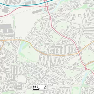
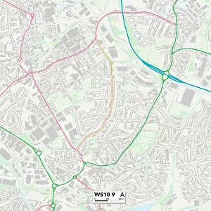
Birmingham B7 5 Map

![]()
Wall Art and Photo Gifts from Map Marketing
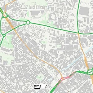
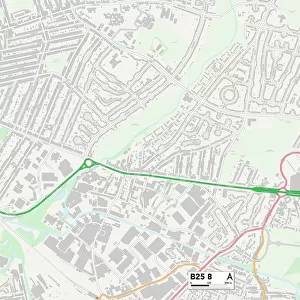
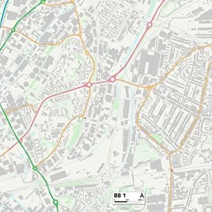
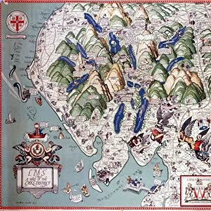
Birmingham B7 5 Map
Postcode Sector Map of Birmingham B7 5
Media ID 19965808
Addison Road Argyle Street Avenue Close Birmingham Brough Close Charles Drive Churchfield Close Cook Street Crompton Close Crompton Road Cromwell Street Fowler Street Freeman Road Johnson Street Long Acre Marton Close Meteor Way Mount Street Oliver Street Park Place Railway Terrace Ramsey Road Rocky Lane St Clements Road Stanley Road Stuart Street Trevor Street Walter Street Watson Road Wharton Street Holborn Hill
FEATURES IN THESE COLLECTIONS
> Animals
> Birds
> Cuckoos
> Little Cuckoo
> Animals
> Birds
> Cuckoos
> Related Images
> Arts
> Artists
> C
> William Charles
> Arts
> Artists
> F
> Walter Field
> Arts
> Artists
> F
> William Fowler
> Arts
> Artists
> O
> William Oliver
> Arts
> Artists
> W
> Henry Walter
> Europe
> United Kingdom
> England
> Birmingham
> Area
> Churchfield
> Europe
> United Kingdom
> England
> Birmingham
> Area
> Nechells
> Map Marketing
> Postcode Sector Maps
> B - Birmingham
> Maps and Charts
> Related Images
MADE IN THE USA
Safe Shipping with 30 Day Money Back Guarantee
FREE PERSONALISATION*
We are proud to offer a range of customisation features including Personalised Captions, Color Filters and Picture Zoom Tools
SECURE PAYMENTS
We happily accept a wide range of payment options so you can pay for the things you need in the way that is most convenient for you
* Options may vary by product and licensing agreement. Zoomed Pictures can be adjusted in the Cart.