Home > Arts > Street art graffiti > Digital art > Vector illustrations
Corona California US City Street Map

![]()
Wall Art and Photo Gifts from Fine Art Storehouse
Corona California US City Street Map
Vector Illustration of a City Street Map of Corona, California, USA. Scale 1:60, 000.
All source data is in the public domain.
U.S. Geological Survey, US Topo
Used Layers:
USGS The National Map: National Hydrography Dataset (NHD)
USGS The National Map: National Transportation Dataset (NTD)
Unleash your creativity and transform your space into a visual masterpiece!
Frank Ramspott
Media ID 15055107
© Frank Ramspott, all rights reserved
Aerial View California City Map Computer Graphic Directly Above Downtown District Gray Road Map Text Corona Digitally Generated Image Green Color White Color
FEATURES IN THESE COLLECTIONS
> Aerial Photography
> Related Images
> Animals
> Insects
> Hemiptera
> Green Scale
> Animals
> Mammals
> Cricetidae
> California Mouse
> Arts
> Contemporary art
> Digital artwork
> Street art
> Arts
> Landscape paintings
> Waterfall and river artworks
> River artworks
> Arts
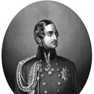
> Portraits
> Pop art gallery
> Street art portraits
> Arts
> Street art graffiti
> Digital art
> Digital paintings
> Arts
> Street art graffiti
> Digital art
> Vector illustrations
> Fine Art Storehouse
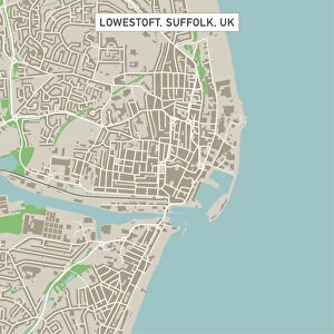
> Map
> Street Maps
> Fine Art Storehouse
> Map
> USA Maps
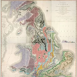
> Maps and Charts
> Geological Map
> Maps and Charts
> Related Images
EDITORS COMMENTS
This print showcases a meticulously detailed city street map of Corona, California, USA. The vector illustration portrays the downtown district with its intricate network of roads and streets, accurately scaled at 1:60,000. Created by Frank Ramspott, this digitally generated image is a testament to his exceptional cartography skills. The map incorporates various layers from reliable sources such as the U. S. Geological Survey's National Hydrography Dataset (NHD) and National Transportation Dataset (NTD). These datasets ensure accurate representation of the city's hydrography and transportation infrastructure. From above, we get a bird's-eye view of Corona's urban landscape adorned with shades of gray for buildings, green for parks and open spaces, blue for rivers and lakes, and white for roadways. This color scheme adds vibrancy to the otherwise monochromatic design while maintaining clarity in depicting physical geography. With no people visible in the image, it allows us to focus solely on appreciating the intricacy of this stunning piece of artistry. The aerial perspective provides an unparalleled understanding of how different elements come together to shape Corona's unique identity as a vibrant city. Perfectly suited for display in homes or offices alike, this visually striking print effortlessly combines functionality with aesthetic appeal. It serves as both an informative guide through Corona's streetscape and an exquisite work of art that captures the essence of this remarkable Californian town.
MADE IN THE USA
Safe Shipping with 30 Day Money Back Guarantee
FREE PERSONALISATION*
We are proud to offer a range of customisation features including Personalised Captions, Color Filters and Picture Zoom Tools
SECURE PAYMENTS
We happily accept a wide range of payment options so you can pay for the things you need in the way that is most convenient for you
* Options may vary by product and licensing agreement. Zoomed Pictures can be adjusted in the Cart.