Home > Science > Space Exploration > Planets > Earth
Earth. Satellite image of the Earth, centred on Antarctica

![]()
Wall Art and Photo Gifts from Science Photo Library
Earth. Satellite image of the Earth, centred on Antarctica
Earth. Satellite image of the Earth, centred on Antarctica. The South Pole is at centre. Water is blue, vegetation is green, arid areas are brown, and snow and ice are white. Both land and ocean floor topography are shown. Antarctica is a frozen continent, permanently covered in snow and ice. Surrounding Antarctica are the waters of the Southern Ocean, mixing with the Atlantic Ocean (upper centre), the Pacific Ocean (lower left) and the Indian Ocean (centre right). Around the edge of the hemisphere is New Zealand (lower centre), Australia (lower right), and the southern parts of Africa (upper right, the island of Madagascar is also seen) and South America (upper left)
Science Photo Library features Science and Medical images including photos and illustrations
Media ID 6349823
© PLANETOBSERVER/SCIENCE PHOTO LIBRARY
Africa Antarctic Antarctica Atlantic Australia Circle Circular Continent Continental Earth Observation From Space Frozen Global Globe Indian Land Pacific Polar Round Satellite Satellite Image Snow South America South Pole Southern Hemisphere Southern Ocean Sphere Spherical
FEATURES IN THESE COLLECTIONS
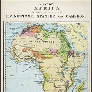
> Africa
> Madagascar
> Related Images
> Africa
> Related Images
> Africa
> South Africa
> Related Images
> Animals
> Mammals
> Muridae
> Water Mouse
> Arts
> Artists
> O
> Oceanic Oceanic
> Europe
> France
> Canton
> Landes
> Oceania
> Australia
> Related Images
> Oceania
> New Zealand
> Related Images
> Science
> Space Exploration
> Planets
> Earth
> South America
> Related Images
EDITORS COMMENTS
This stunning print captures the beauty and complexity of our planet, Earth. Taken from a satellite image, it showcases Antarctica at its center, with the South Pole prominently displayed. The various colors depict different features of our world - blue represents water bodies, green symbolizes vegetation, brown signifies arid areas, and white portrays snow and ice. Antarctica is showcased as a frozen continent perpetually covered in snow and ice. Surrounding this icy landmass are the waters of the Southern Ocean blending with the Atlantic Ocean in the upper center, Pacific Ocean in the lower left corner, and Indian Ocean in the center right portion of the image. Alongside these vast oceans lie New Zealand to the lower center, Australia to the lower right side, southern parts of Africa on its upper right (including Madagascar), and South America on its upper left. The photo also reveals both land and ocean floor topography across this hemisphere-shaped representation of Earth. It serves as a reminder that our planet is an interconnected system where every element plays a crucial role. This snapshot offers us a glimpse into Earth's mesmerizing beauty while highlighting its diverse geographical features. It reminds us how fortunate we are to call this remarkable planet home.
MADE IN THE USA
Safe Shipping with 30 Day Money Back Guarantee
FREE PERSONALISATION*
We are proud to offer a range of customisation features including Personalised Captions, Color Filters and Picture Zoom Tools
SECURE PAYMENTS
We happily accept a wide range of payment options so you can pay for the things you need in the way that is most convenient for you
* Options may vary by product and licensing agreement. Zoomed Pictures can be adjusted in the Cart.