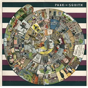
Home > Europe > United Kingdom > England > London > Sights > Hyde Park
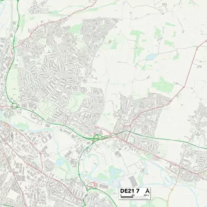
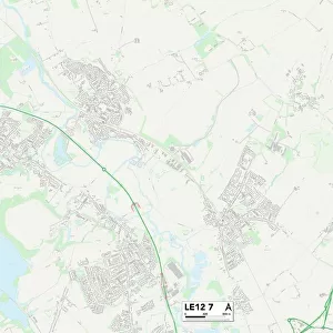
Leicester LE10 3 Map

![]()
Wall Art and Photo Gifts from Map Marketing
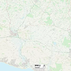
Leicester LE10 3 Map
Postcode Sector Map of Leicester LE10 3
Media ID 19974934
Aston Lane Bracken Drive Brindley Road Brookfield Brookfield Drive Butler Close Chapel Lane Chapel Street Church Close Church Hill Church Lane Coal Pit Lane Coopers Close Coventry Road Croft Close Faraday Road Field Close Fleming Road Fosse Close Gipsy Lane Green Lane Hall Lane Hall Road Higham Lane Hinckley Road Leicester Leicester Road Lutterworth Road Manor House Close Meadow Close Mere Lane Mill Lane Mill Row Moat Lane Newton Road Nuffield Road Orchard Close Park View Parsons Lane School Lane St Helens Close Stephenson Road Stoke Lane Stoke Road Tamarisk Close The Close The Square Watling Close Watling Street Whittle Road Workhouse Lane Temple Hill Wolvey
FEATURES IN THESE COLLECTIONS
> Animals
> Mammals
> Muridae
> Heath Mouse
> Arts
> Artists
> F
> Newton Fielding
> Arts
> Artists
> H
> Helen Hyde
> Europe
> United Kingdom
> England
> London
> Sights
> Hyde Park
> Map Marketing
> Postcode Sector Maps
> LE - Leicester
> Maps and Charts
> Related Images
MADE IN THE USA
Safe Shipping with 30 Day Money Back Guarantee
FREE PERSONALISATION*
We are proud to offer a range of customisation features including Personalised Captions, Color Filters and Picture Zoom Tools
SECURE PAYMENTS
We happily accept a wide range of payment options so you can pay for the things you need in the way that is most convenient for you
* Options may vary by product and licensing agreement. Zoomed Pictures can be adjusted in the Cart.